Small movements in the ground can have a big impact on operations, infrastructure, and construction projects across different sectors. With the ability to monitor deviations down to the millimetre level, it is possible to uncover potential challenges in ground stability early enough to take measures to reduce costs and the risk of damage.
NGI and KSAT are therefore collaboratively launching the Inio satellite service to precisely detect such movements. Inio is a global service that will be able to assist industry, regional and local authorities and transport projects in understanding and predicting ground movements.
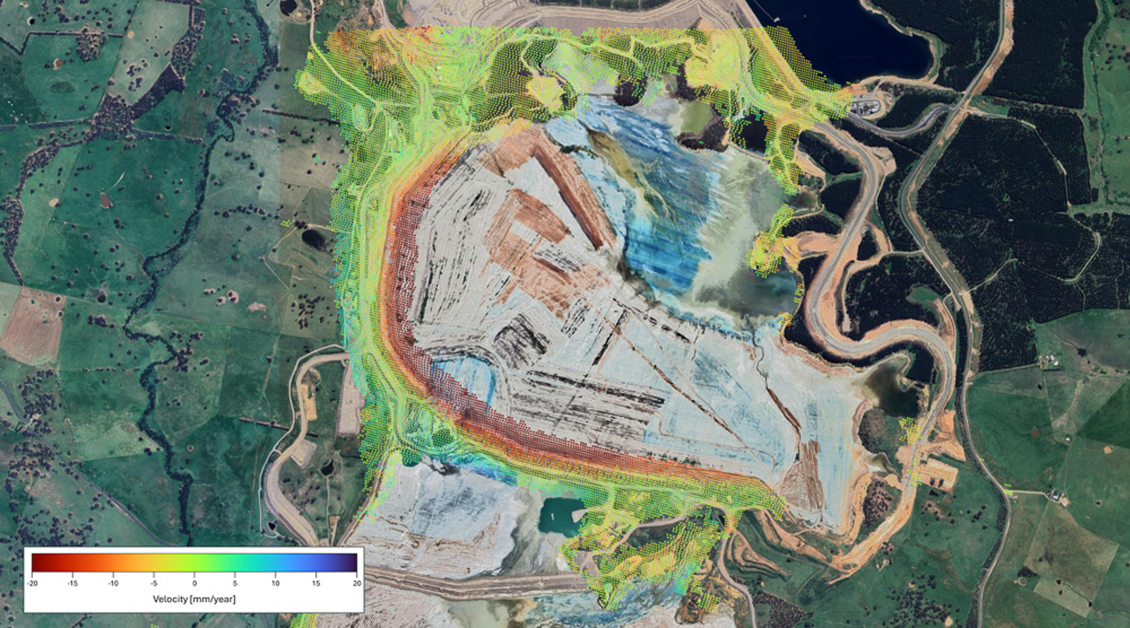
The ground movements are measured with radar satellites through a technology called InSAR. Through this technique, small differences in the radar signals can be interpreted as changes in motion towards the satellite (uplift) or away from the satellite (subsidence).
NGI and KSAT to collaborate.
Managing Director of NGI, Lars Andresen, believes that the technology can contribute to improving public safety: “This service is developed based on NGI's strategy to contribute to digitalization and increased data sharing in the industry, and has the potential to deliver monitoring of ground movements with much higher quality and lower cost than traditional methods”- says Andresen.
The service is being launched together with KSAT, a world-leading provider of ground services for satellites in polar orbit. KSAT, which also provides environmental monitoring services in near real-time based on satellite data, is now aiming to scale terrestrial observation using satellites.
“Teaming up with NGI to deliver important satellite-based solutions is a great example of how Norway can offer leading expertise globally by connecting different and complementary expertise. NGI are experts in ground conditions, while KSAT are experts in the handling and utilization of satellite data,” says Rolf Skatteboe, CEO and President of KSAT.
“Therefore, the new service Inio has great potential, also internationally, because we combine world-leading expertise in two areas, which together make the service completely unique”- Skatteboe adds.
Specialist excpertise and InSAR.
NGI is a leading research institute in geotechnics—the field concerned with understanding the properties of the ground related to construction and other human impacts. NGI has been utilizing InSAR in research and commercial projects for over 15 years and is now fully committed to the development of the Inio service. The service will contribute to increased utility for InSAR users, including those who have not yet adopted the technology.
Find out more about the Inio services here
Cover photo: Displacement measurements over a tailings dam, processed by NGI, using Sentinel-1 data from the Copernicus Programme