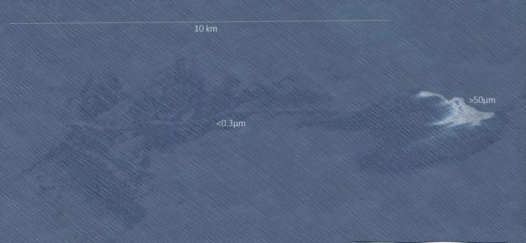
As we all know, oil spill contingency and preparedness planning require near-real-time and relevant information about a potential oil slick. Oil slicks can cover several square kilometres at sea and forecasting the drift from a large spill might result in even more uncertainties in the drift and fate of the oil. For several decades, Synthetic Aperture Radar (SAR), has been used to detect oil slicks at sea.
Extracted from SAR and optical
Now a new study by KSAT earth observation experts Martine Espeseth, Hugo Isaksen and Knut-Frode Dagestad from the Norwegian Meteorological Institute demonstrates how to initiate the drift model from oil masks with thickness variations extracted from both SAR and optical.
– In this way information about the thickest parts of the oil can be incorporated into the forecast, thus focusing efforts on the actionable oil in a potential clean-up scenario, project Manager Dr Martine Espeseth at KSAT points out.
These are products developed with CIRFA: Centre for Integrated Remote Sensing and Forecasting for Arctic Operations and The Norwegian Meteorological Institute.

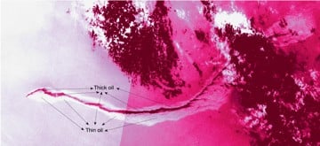
Thick oil appears heated (bright in optical). Thin oil appears “cool” (dark in optical). Thick oil is located only in a small fraction of the total area. Image: Sentinel-2, cc: Copernicus
The experts will present the paper at the Interspill conference in Amsterdam 21-23 June. The conference covers a broad range of topics related to oil and pollution response as well as marine governance.
Combining detection and oil thickness
A satellite image from either SAR or optical contains much more information than just detecting the oil.
– By combining the detection and relative oil thickness into a drift model we will be able to provide information about the detection, oil thickness in that satellite image, and where the thick and thin oil is heading, Espeseth says.

The conference presents an opportunity for professionals from the international spill response community, private sector, government, and non-governmental organizations to come together to tackle the greatest challenges with sound science, practical innovation, social engineering, global research and imagination.


