Interspill 2025, London
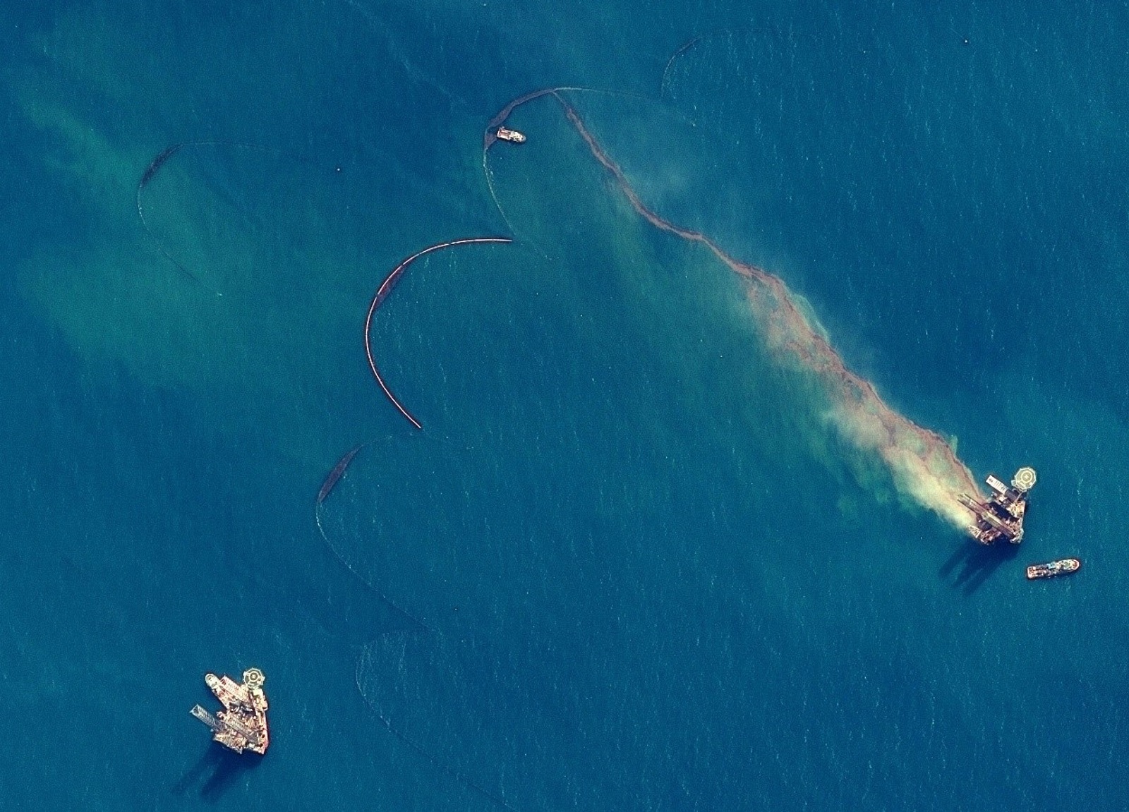
At this year’s conference, the KSAT Oil Spill Detection team is sharing their experience in using machine learning (ML) to detect oil spills in satellite imagery. This is a technology with the potential to make marine emergency response faster, smarter, and more reliable.
Responding quickly to pollution at sea often means working with limited time and incomplete information. Satellite images are a powerful tool for seeing the bigger picture but interpreting them requires both expertise and capacity, especially when the clock is ticking. That’s where machine learning can help.
From incoming image to actionable insight with ML
We have explored two approaches for identifying oil slicks in satellite images, developed with operational use in mind. Over 25 years of expert-labelled data provides an excellent foundation for training the models and their ability to recognize and understand real-world variations.
The goal is not to replace human analysts, but to help them focus attention where it matters most.
Both methods are designed to support near real-time workflows, helping teams move quickly from incoming image to actionable insight.
In practical terms, this means:
- faster situational awareness
- better prioritization
- more informed decisions.
Automated detection combined with human validation
Crucially, performance isn’t judged only by standard ML metrics like precision or recall. Outputs are also evaluated by the people who know the operational context best- expert operators who understand the difference between a false positive and a real risk. Their feedback ensures that the system isn’t just technically impressive, but genuinely useful.
To ensure quality and trust, we combine automated detection with human-in-the-loop validation. The system flags potential spills, but final assessments are made by trained professionals. It’s a partnership between data and domain knowledge - and one that evolves as new data, sensors, and user needs emerge.
In our poster at the conference, we also discuss the application of two well-established machine learning methods:
- Foundation models, which provide a broader, more complete understanding of Earth observation data by leveraging knowledge from multiple tasks and data sources
- Multi-backbone neural networks, which we apply to introduce richer context to the model’s decision-making process.
While the algorithms run quietly in the background, the aim is very concrete: to protect the ocean and coastline from the long-term damage caused by oil pollution.
With scalable infrastructure and a flexible architecture, the system is also well positioned for future expansion into other types of marine monitoring.